The Gokyo Valley Trek is one of the most beautiful and rewarding treks in the Everest region of Nepal. This scenic Himalayan journey takes you to the turquoise Gokyo Lakes, the breathtaking summit of Gokyo Ri, and traditional Sherpa villages set beneath some of the world’s highest mountains. If you want a quieter alternative to the busy Everest Base Camp trek, the Gokyo Valley Trek is an excellent choice.
At Mountain Eco Trails, we offer this trek for travellers who want incredible mountain views, a peaceful trail, a local cultural experience, and well-paced trekking days.
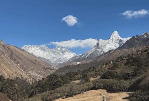
The route combines alpine lakes, glacier scenery, high Himalayan landscapes, and warm Sherpa hospitality. Along the way, you will enjoy unforgettable views of Everest, Lhotse, Makalu, and Cho Oyu. With moderate difficulty, the Gokyo Valley Trek takes around 10-12 days to complete.
Whether you are looking for a scenic Everest region adventure, a well-designed Gokyo Valley Trek itinerary, or a trusted local company for your next Himalayan journey, this trip offers the perfect balance of beauty, challenge, and comfort.
Do you know, you can do the Everest Gokyo Valley Trek in 15 Days, combining the trek with Everest Base Camp.
Why Choose the Gokyo Valley Trek?
The Gokyo Valley Trek is ideal for travellers who want more than just a famous trekking name. This route gives you a deeper and more peaceful experience in the Khumbu region. It is one of the best treks in Nepal for people who enjoy natural beauty, alpine lakes, and panoramic mountain viewpoints.
- A Quieter Alternative to Everest Base Camp: While the Everest Base Camp trail is more famous, the Gokyo route feels calmer, more scenic, and often more relaxing.
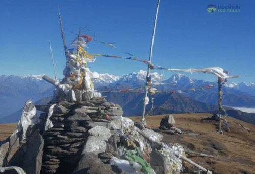
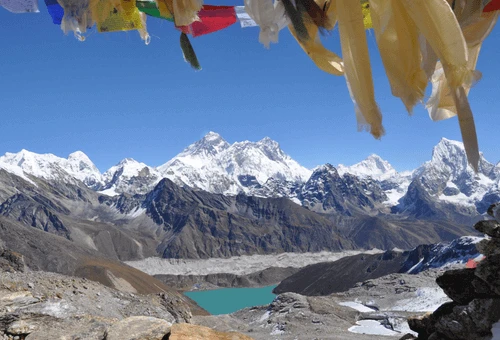
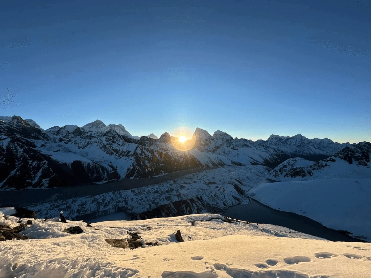
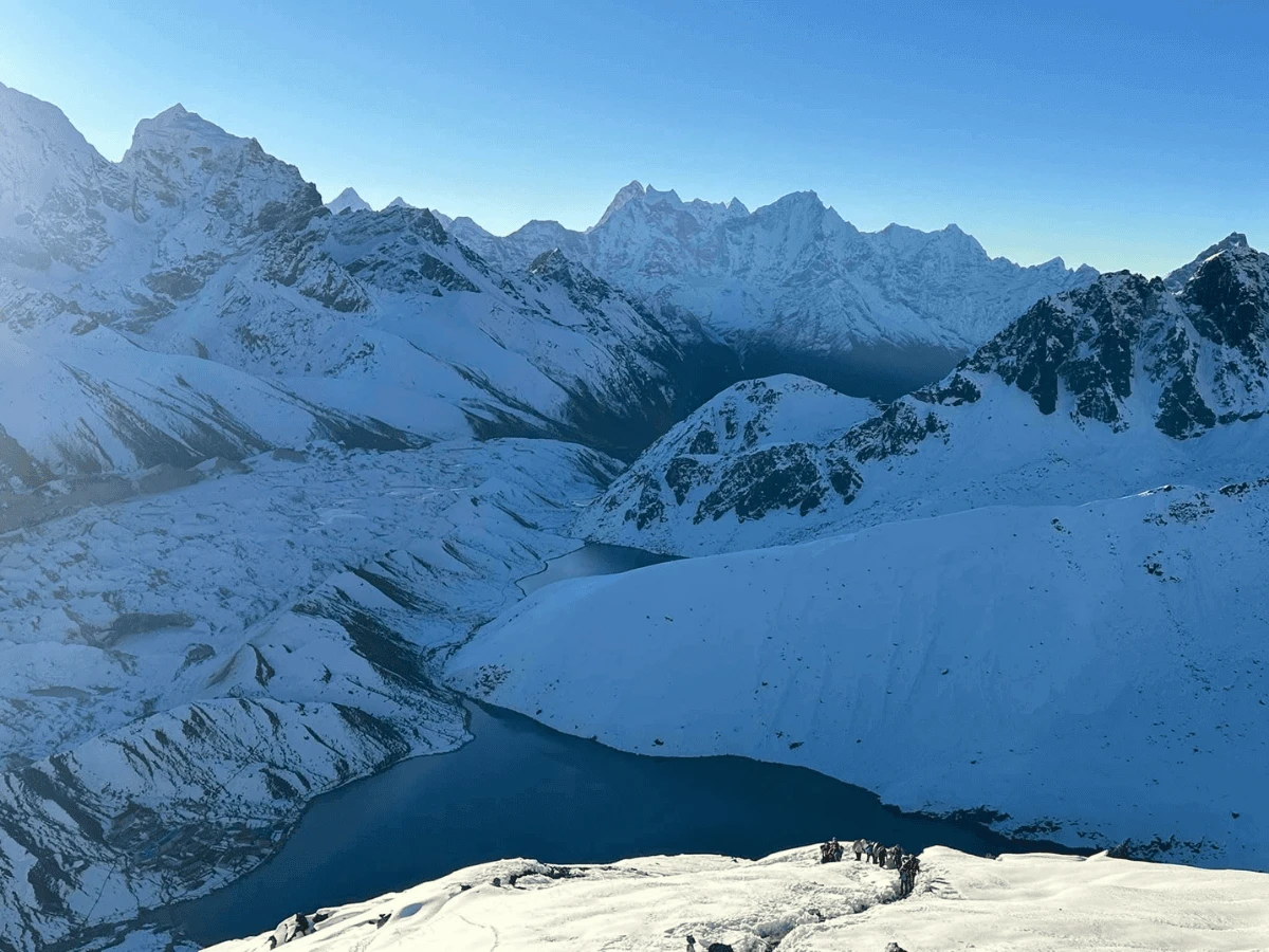
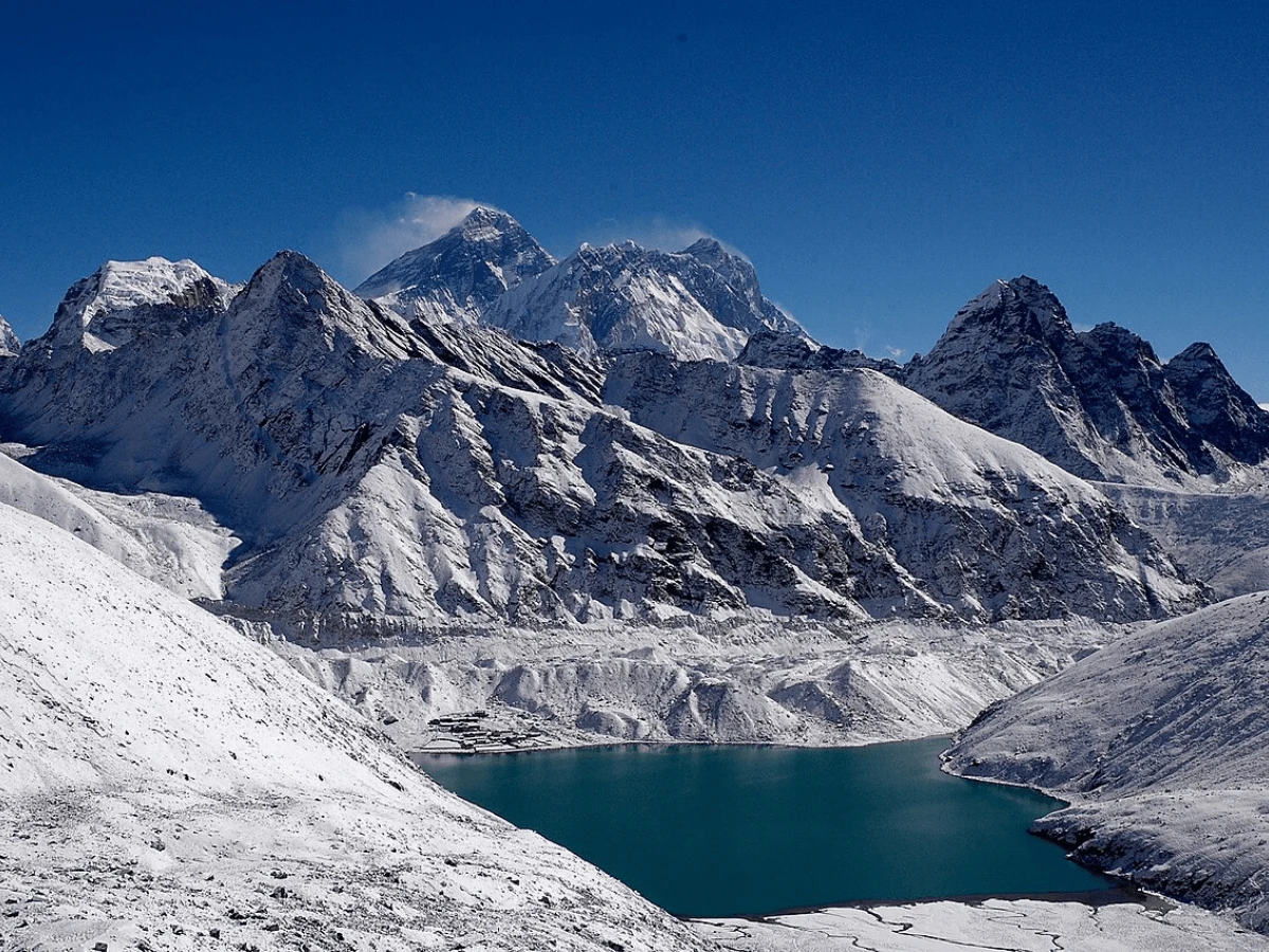
- Beautiful Gokyo Lakes: The chain of turquoise Gokyo Lakes is the highlight of the journey.
- Spectacular View from Gokyo Ri: From the top, you can enjoy a wide Himalayan panorama that includes Everest, Lhotse, Makalu, and Cho Oyu.
- Rich Sherpa Culture: Pass through traditional Sherpa villages, prayer flags, monasteries, and teahouses.
- Gokyo Valley Trek is ideal for Scenic Trekkers
10-Day Gokyo Valley Trek cost 2026,2027
The Gokyo Valley Trek cost depends on group size, guide service, domestic flight rates, season, and trip customisation. A standard package usually includes guide service, airport transfers, permits, accommodation during the trek, and domestic flights where applicable. Besides the package price, trekkers should also plan for personal expenses such as travel insurance, drinks, charging, WiFi, tips, and extra snacks along the trail.
Cost Component | Estimated Cost |
Standard Gokyo Valley Trek Package | USD 1299– 1,499 |
Kathmandu to Lukla Return Flight | USD 508 |
Sagarmatha National Park Permit | USD 30 |
Khumbu Municipality Permit | USD 30 |
Licensed Trekking Guide | USD 35-40 per day |
Porter Service (optional) | USD 25 – 30 per day |
Teahouse Accommodation | USD 5 – 10 per night |
Meals During Trek | USD 30 – 35 per day |
Taxes and Administrative cost | USD 100-150 |
Mountain Eco Trails offers this 10-Day Gokyo Valley Trek Package at a cost starting from USD 1,200 up to $2,500 per person. If you need more information regarding the cost details, feel free to contact us via email or WhatsApp us at +9779849790153.
Join Mountain Eco Trails for the 10-Day Gokyo Valley Trek
Trek with Mountain Eco Trails for a professionally organised and eco-conscious adventure in the Himalayas. Mountain Eco Trails is a leading local trekking company in Nepal known for its commitment to sustainable travel and excellent client service. Choosing to do your Gokyo Valley Trek with Mountain Eco Trails means you’ll benefit from experienced Sherpa guides, well-planned itineraries, and personalised attention every step of the way. Here are the benefits of choosing Mountain Eco Trails for the Gokyo Lake Trek in Nepal:
- Complimentary Airport pick-up and drop-off. (if needed)
- An experienced trekking guide who knows the trail like a home.
- Hassle-free last-minute booking and trek arrangements.
- Trekking Poles, Duffel Bag, and SIM card if needed.
- First Aid Kid carried by the trekking Guide.
- Regular communication with the trekking leader during the trek.
- A complimentary farewell dinner before departing from Nepal.
- Complimentary Trekker's Massage after the trek
If you are still confused about any of the services, feel free to contact us via email or WhatsApp at +9779849790153.